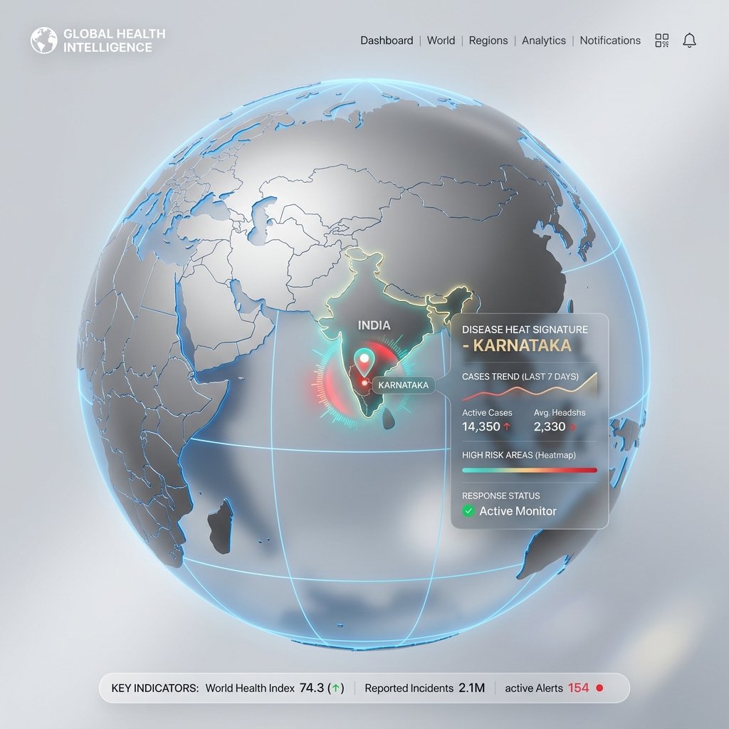
GeoHealth Karnataka is a revolutionary 3D geospatial platform that maps, tracks, and predicts disease outbreaks by correlating public health data with climate, water, and demographic vectors.
Health crises are driven by geography. Malaria breeds in monsoon runoff. Fluorosis stems from Deccan Plateau groundwater. Kyasanur Forest Disease is localized to Western Ghats tick vectors. Without correlating location, climate, and demographics, health systems are reacting to crises instead of predicting them.
GeoHealth utilizes a seamless drill-down navigation architecture. Users begin at a WebGL 3D Earth globe, zooming directly into Karnataka, revealing a highly detailed 31-district choropleth heat map.
Districts are colour-coded based on actual surveillance data. Red indicates severe outbreaks requiring immediate intervention.
Toggle between Communicable, Non-Communicable (NCD), Vector-Borne, and Water/Soil chemical contamination layers.
Karnataka's vast geographic diversity requires highly specific health intelligence. We segment the state into four distinct climatic and dietary zones, mapping specific diseases to their environmental triggers.
Districts: Dakshina Kannada, Udupi, Uttara Kannada
Heavy monsoon environment. High vulnerability to Malaria, Dengue, and Leptospirosis (due to paddy farming exposure).
Districts: Shivamogga, Chikkamagaluru, Kodagu
Forest terrain. Epicenter of Kyasanur Forest Disease (KFD/Monkey Fever) driven by tick vectors. Monitored via live monkey death alerts.
Districts: Bengaluru, Mysuru, Tumkuru
High urban density. Massive Non-Communicable Disease (NCD) burden including Diabetes, Hypertension, and Road Traffic Injuries (RTI).
Districts: Kalaburagi, Raichur, Yadgir, Bidar
Hot, semi-arid terrain. Dental and Skeletal Fluorosis is endemic here due to heavily contaminated groundwater passing WHO limits.
Selecting any district generates modular Disease Intelligence Cards. This is the heart of the application, rendering complex epidemiological data into actionable insights for both citizens and health officials.
Every disease tracks exact breakdown by age bands and gender. Notably, the module explicitly tracks Male, Female, and Transgender data parameters to ensure inclusive public health equity.
Every DIC provides evidence-based treatments, prophylactic measures, vaccine availability, and regional dietary recommendations (e.g., Ragi Mudde for diabetic protection in South Karnataka).
GeoHealth Karnataka operates on a strict "No Hallucination" policy. In AI-driven healthcare, estimated or fabricated data can cost lives. Our system architecture enforces strict epistemological rules: